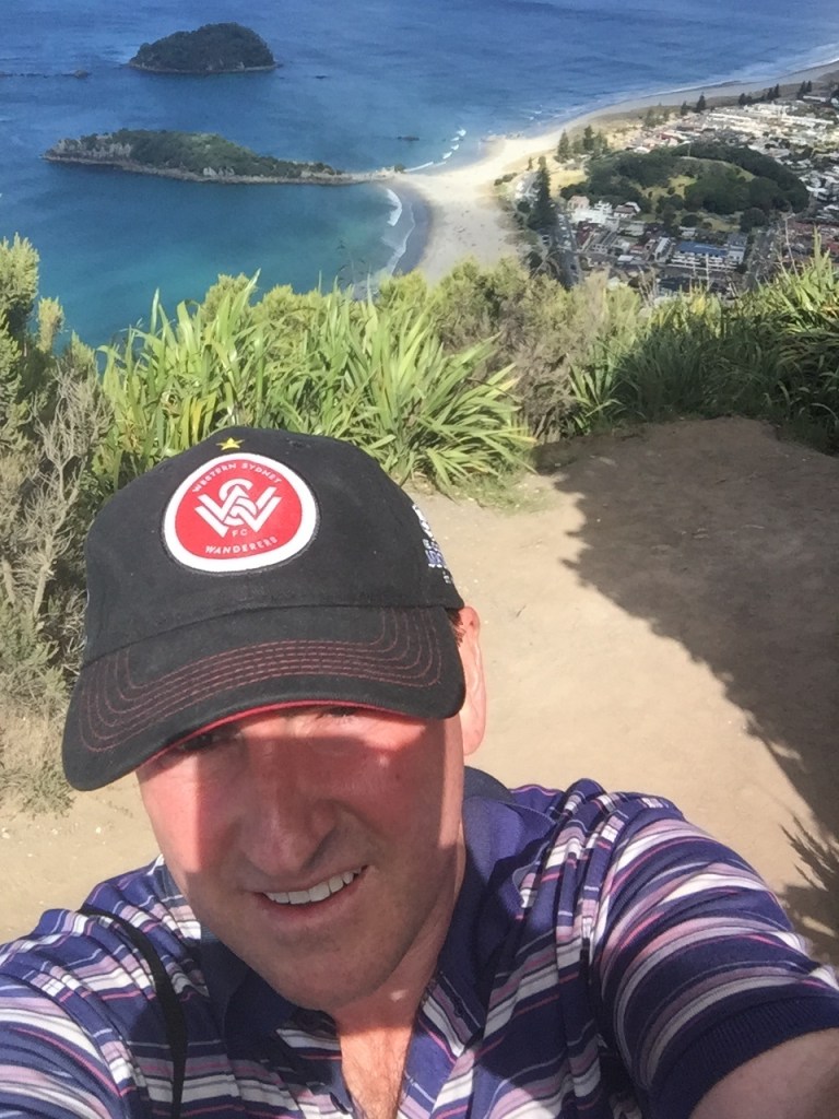
From the summit of Mount Maunganui in early 2017. This landmark played a pivotal role in ‘MADAME TAURANGA’ and visiting here helped in writing the scenes set in New Zealand.
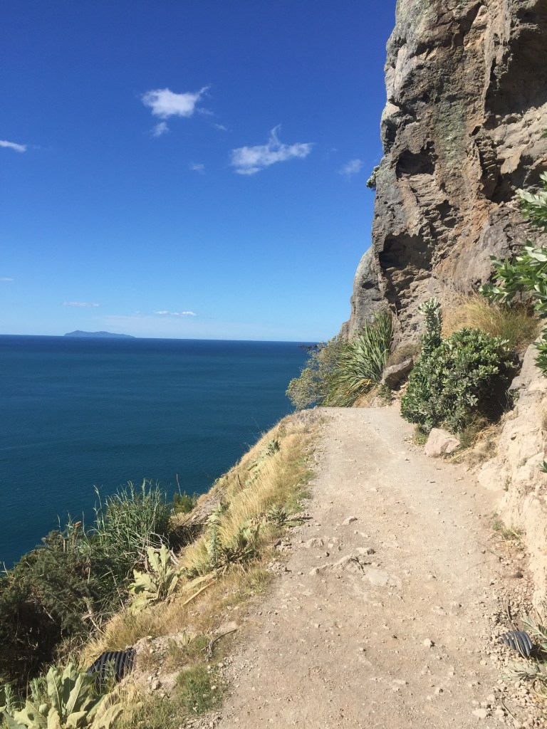
A very gruelling and at times treacherous hike.
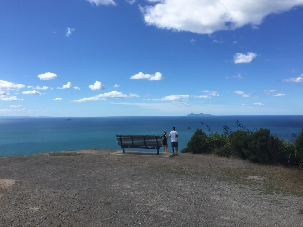
This photo was taken from the summit, overlooking the Pacific Ocean and became the cover for the book. (With the two people photo-shopped out, of course.)
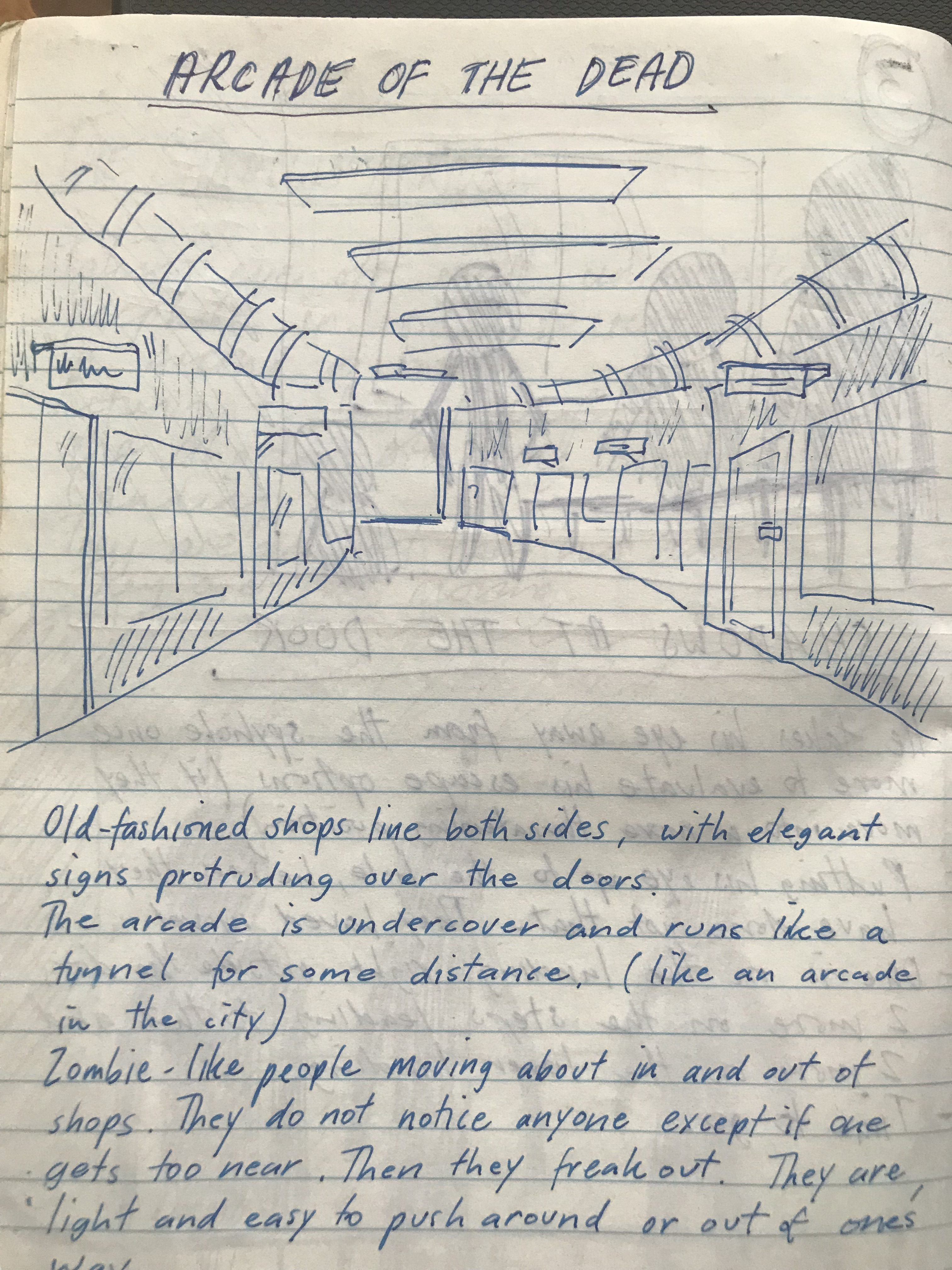
An illustration and description of a nightmare I experienced. A version of this appeared in ‘MADAME TAURANGA’ as the shopping centre scene.

Another scene from the same book was derived from a strange dream that I experienced and wrote down. This was the psychic connection sequence, with the vision of the seaside village.

Drawing up maps of fictitious places is a useful tool to prevent plot holes and other narrative errors. This is an original map that was later divided up into two different towns: – Russell’s Retreat (for VINDICTIVE PURSUITS and NINE MILE BEACH) and Denne (for BARREN POINT ROAD).

This map was drawn on the inside cover of my note book for ‘THE LAST DON OF DACY STREET’. It was very important to have a visual guide as to where the different shops were situated. This helped in describing the locations of the businesses in relation to each other, such as ‘three doors down’ or ‘directly opposite’ and so forth.
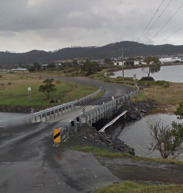
Droughty Point Road in Rokeby, Tasmania.
When I was a kid growing up, this used to be an old wooden bridge and I used this for the setting of a pivotal scene in ‘BARREN POINT ROAD’.
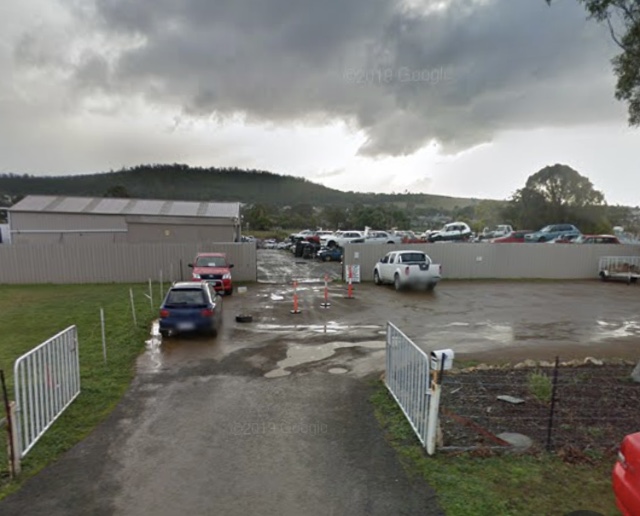

Two more scenes from ‘BARREN POINT ROAD’ shown from Google Street View.
The first photo is the wrecking yard, enclosed in a sheet iron fence. The second shot is of the entrance to the sewerage works. Both are encountered by the young boys as they ride their bikes along the forbidden road for the first time.
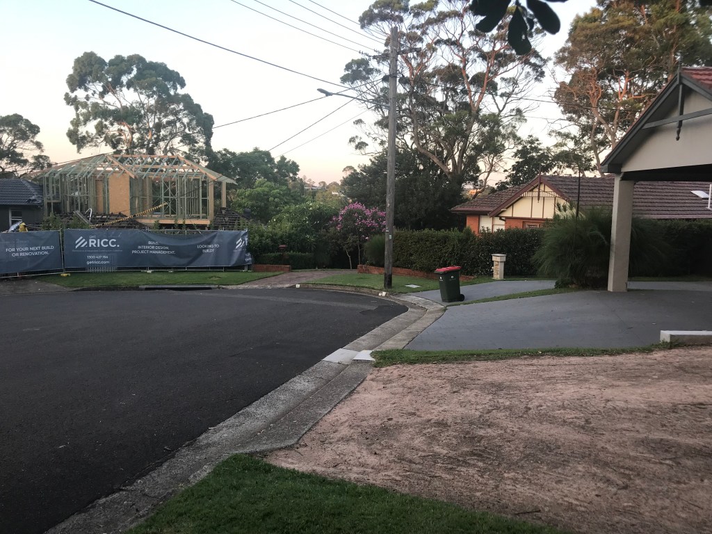
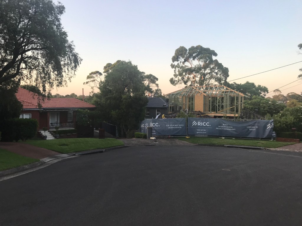
Laura Street in Gladesville, a quiet cul-de-sac in an affluent part of town.
I had the layout of this location in mind when writing ‘THE CHANT SOCIETY’.
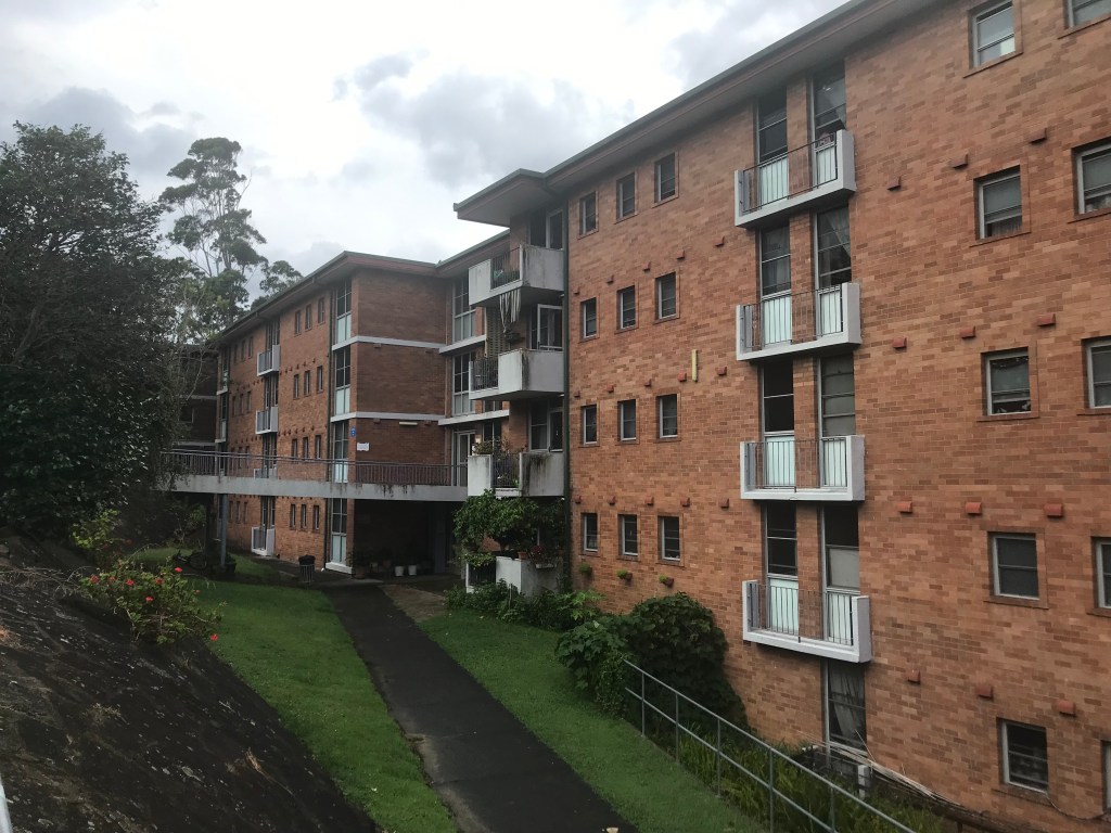
The leviathan that is the public housing estate on Myers Avenue in Gladesville.
This was the inspiration for one of the questionable addresses in ‘LOCKDOWN DRIVER WANTED’.

As described in the story, complexes like these are ‘hidden from view’ from the rest of the wealthy neighbourhood.
As a result, the Myers Avenue apartments are right on the border with the Lane Cove National Park.
This would give any of the top floor units a million dollar view, so good luck to them!
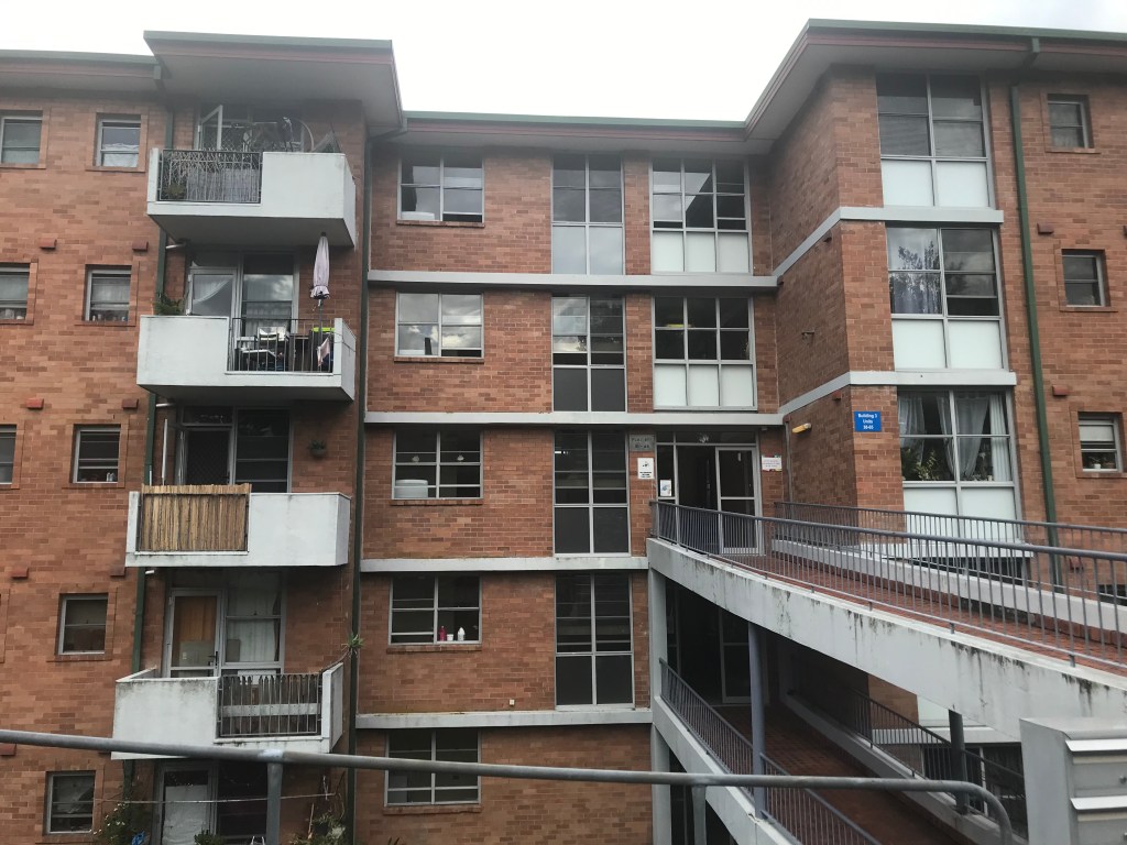
The entrance to the Joubert Street housing commission flats in mega-rich Hunters Hill, and setting for the most outrageous incidents in ‘LOCKDOWN DRIVER WANTED’.
To be fair, the place has undergone an upgrade since I was last there, with the metal railings opening things up a lot more.

It still has the closed-in penitentiary look, as described in the story.
This complex is not hidden from sight as most of the other housing buildings nearby are.
Hiding in plain sight may be a better description.

The map of the ‘First Nations Territory’ as depicted in the 2023 novel ‘THE VISION’.
Most of the story takes place on the eastern side of the map, where you can see Lake Frome, and just a little down and to the right lies Broken Hill.
Below are some locations featured in the story, courtesy of Google Maps.
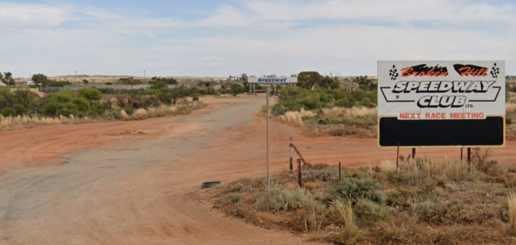
The Broken Hill Speedway.

The unusual anomaly just outside of the Silver City.

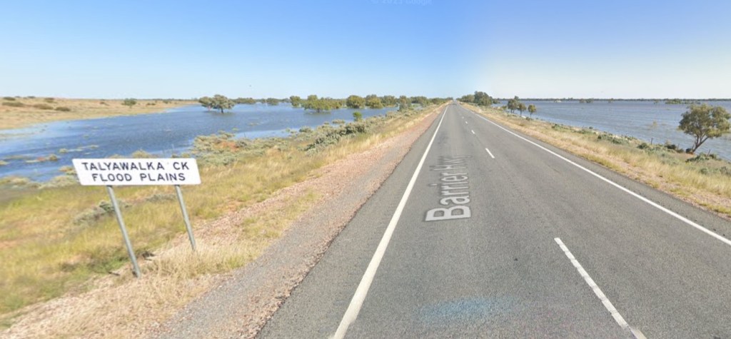
The flood plains experienced by the adventurers during the drive to Broken Hill.
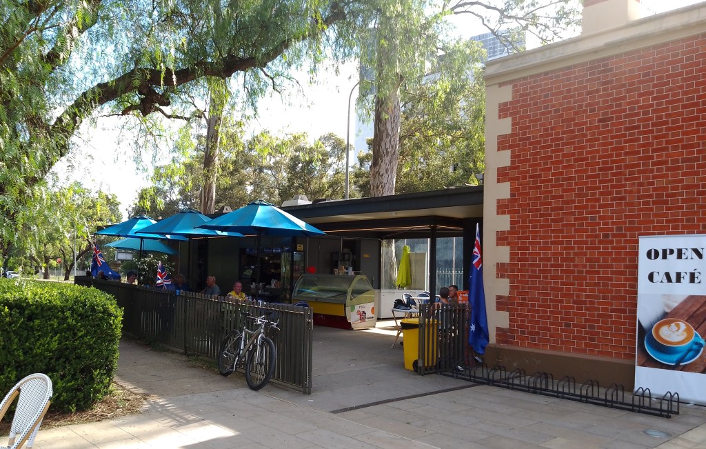
The cafe at Parramatta Park was an early setting in the novel ‘THE VISION’.
Although the description in the book was of a larger coffee shop, the photo above is of the actual cafe that was the inspiration for the conspirators’ favourite meeting place.
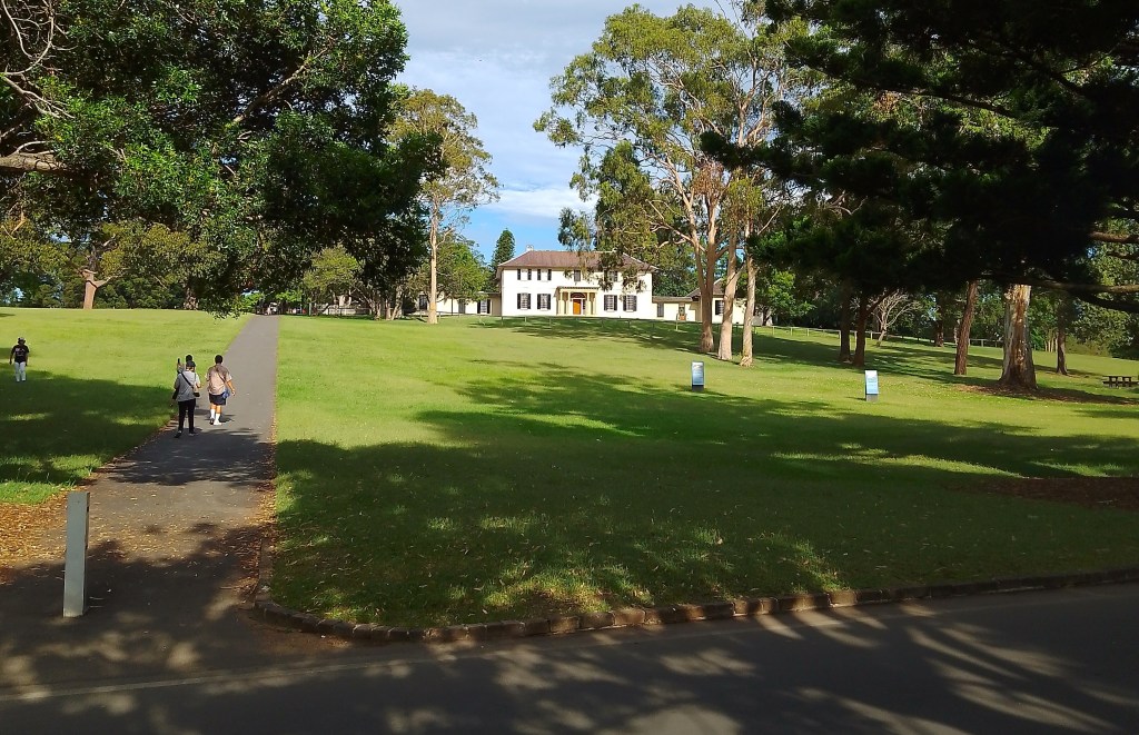
As mentioned in the novel, the picturesque view from the cafe was of a pathway leading up a small hill to Old Government House.

A graphic design of the Wayne Fox premiership guernsey from ‘HOBART 1983’.
It helps to create an image of a plot device you are writing about, so it can be referred back to in order to ensure accuracy and consistency every time it is described in the book.
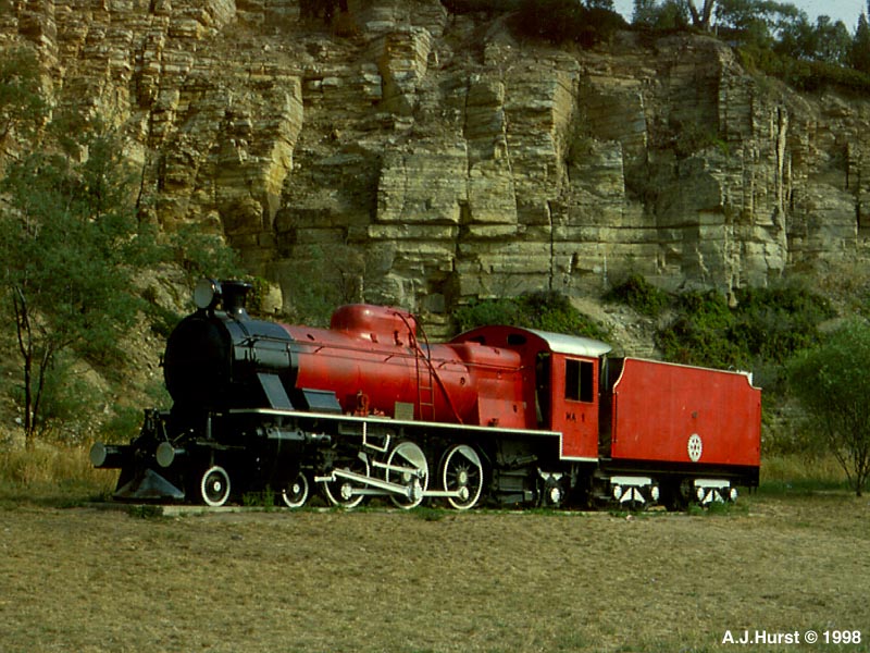
The Granton Train Park from ‘HOBART 1983’ was in fact a real place.
Here is a photo of the old locomotive in a rare moment when kids aren’t climbing all over it.
(Photo is courtesy of A J Hurst.)
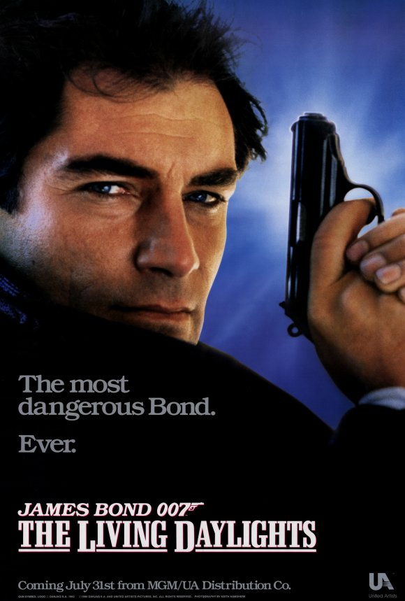
This is similar to the movie poster that plays a small role in ‘THE BLIND DATE BALL’, with its purpose as a plot device being to trigger a reaction from the main character – which it does – and is also a reminder of what year the story is set.
