I installed a flight tracker app today and thought I might have a little fun.
It did not take long for me to find C310 flying over the Blue Mountains, and decided to track its movements.
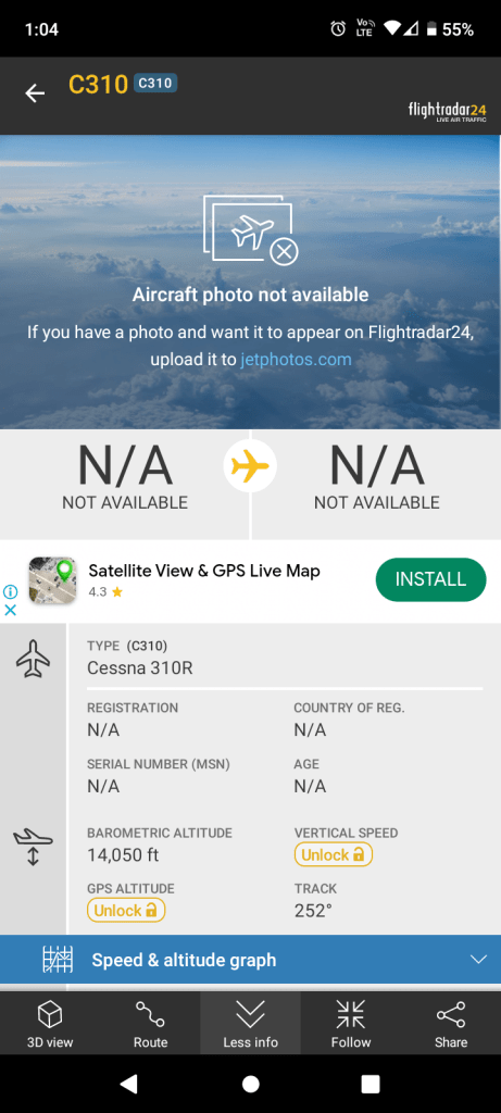
There was not a lot of information about the plane, only its altitude and type, but I can tell you that it took off from Bankstown Airport and returned there a couple of hours later.
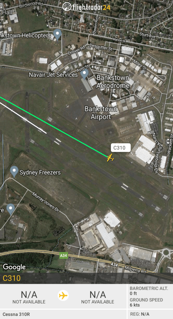
But what exactly was it doing? Check out the flight path below.

Mapping? Chem Trails? Your guess is as good as mine.
